New survey features in Deswik.CAD 2017.1 & 2017.2
In 2017 there have been over 50 enhancements added to the roadmap and at present over 60% of them have been added into the CAD platform. Most of the remaining enhancements are tied into point cloud handling. For a more in-depth explanation, see the help file for each of these commands.
Tools | Survey | Create Face Markers
Face positions can be generated along design centerlines using distances from known points such as survey stations and laser. These markers get attributed with the date, user and any other additional information (such as the operational attributes for the mine). The tool also calculates how many blasts there have been from the measure point based on the average blast length specified in the tool.

Tools | Survey | Create Laser Line
This creates a laser line from known points and a design centerline. From a known backsight the laser is generated with set offsets, minimum distance from the wall, set tunnel profile.
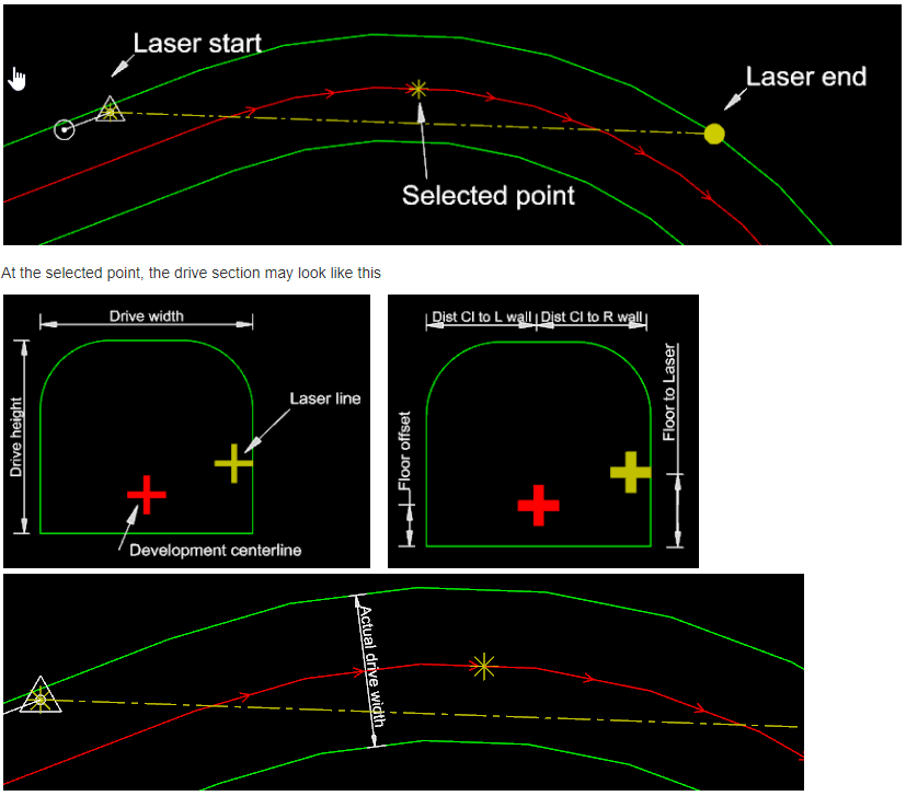
Another use for this function is to generate the longest possible laser, select the centerline, design and minimum offset from the wall and the longest laser will be generated. This can then be uploaded to the instrument to help aligning lasers along tricky drive sections.
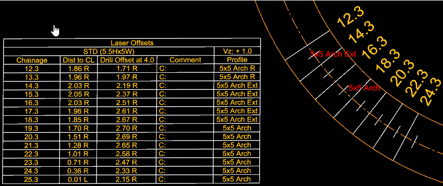
Tools | Survey | Laser Offsets (enhancement)
This has been given more user customization for the table contents. Not only can the order of the columns be configured but text values and vertex values can be used. The vertex values can be taken from a design centerline (in this example the drive profile is used) and used to fill in the table, this way any changes in the profile are filled in the table for operators to use. A color filled outline can be created to highlight the section of the mine to be excavated.
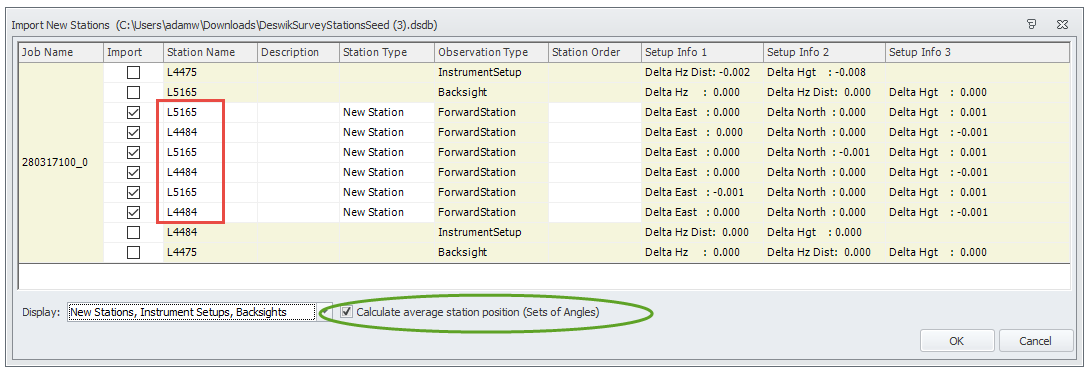
Tools | Survey | Import Jobs: Sets of Angles
While Sets of Angles data is usually processed in a third party least squares adjustment program, the calculated coordinates can be processed to be added to the database. The user is given the option to un-check the imported stations should they exceed the tolerance, any that are still permissible will be imported into the database either as a station for each set or a straight average is taken to import a single calculated station.
Tools | Survey | Option (enhancements)
The tolerances can be assigned for each of the residuals from the setup observations on Leica instruments. When a job is processed, any tolerance which exceeds these values, the cell gets highlighted red and the import function will alert the user about the tolerance exceedance and whether they want to import the job. Should the job be imported then the ledger will have “PROCESSED OUT OF TOLERANCE” written on the description column. If a new station’s residuals are out of tolerance, then it will write “F” (for fail) in the Station Order column. Polyline Vertex Attributes can be set in the options to assign unique values to the data to be imported. Such examples would be Surveyed Date, Job Name & Surveyed By. The job specific information gets written into the vertex and allows anyone to query the as-built data and find out who and when it was surveyed.
Tools | Survey | Trace Station Origins
The attribute Backsight Station which is recorded in the database can be used to find out the origin of a survey stations, i.e. which baseline it came from. Yellow lines indicate surveyed forward from the queried station.
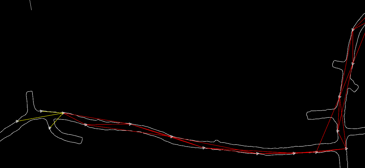
This will work with stations which have used Sets of Angles or Backsight Station in which case a green line will be generated from the station queried to indicate the backsight.
Survey Roadmap
While incremental enhancements will be added, the majority of the survey development is now directed towards point cloud handling. 2018.2 will feature the ability to handle up to 200 million points in the model space and visualize and modify the RGB and intensity values. The attention will then focus on cloud functionality and solid generation for both underground and surface operations.
For more information about these functions or how we can help transition your survey department from the existing software to Deswik, please contact your local support office and one the surveying consultants will be in contact with you.
Stephen Rowles
Product Manager – Survey
